
Nature and adventure trail
· Ramsau am Dachstein
As well as its large playhouse and the Kleine Ramasuer Wasserwelt (the Small Ramsau Waterworld), the Österreichisches Wandergütesiegel (Austrian hiking seal of quality) nature and adventure trail also offers three via ferrata for children and young people. Part of the trail is also suitable for prams.
The starting point of the nature and adventure trail is at the foot of the Sattelberg, around 150m from Concordia guesthouse. It takes about 20 minutes to walk from Ramsau Kulm to the starting point of the circular three-hour trail. From station 1 to 3, the trail leads through hilly and flat forests. It then heads up Sattelberg to a flat area between stations 5 and 6, which is perfect for resting in before the hike up to station 7, the Sattelberggipfel.
Walking time: approx. 70 minutes
At the top, you can see the path winding through the forest to station 11. The trail continues along the edge of the forest, through clearings and high grass to the final station, number 14.
Gallery
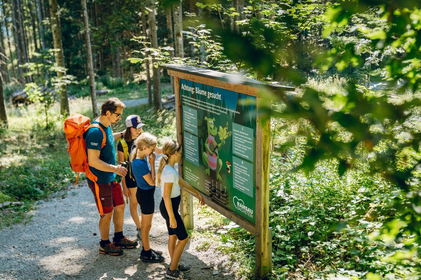


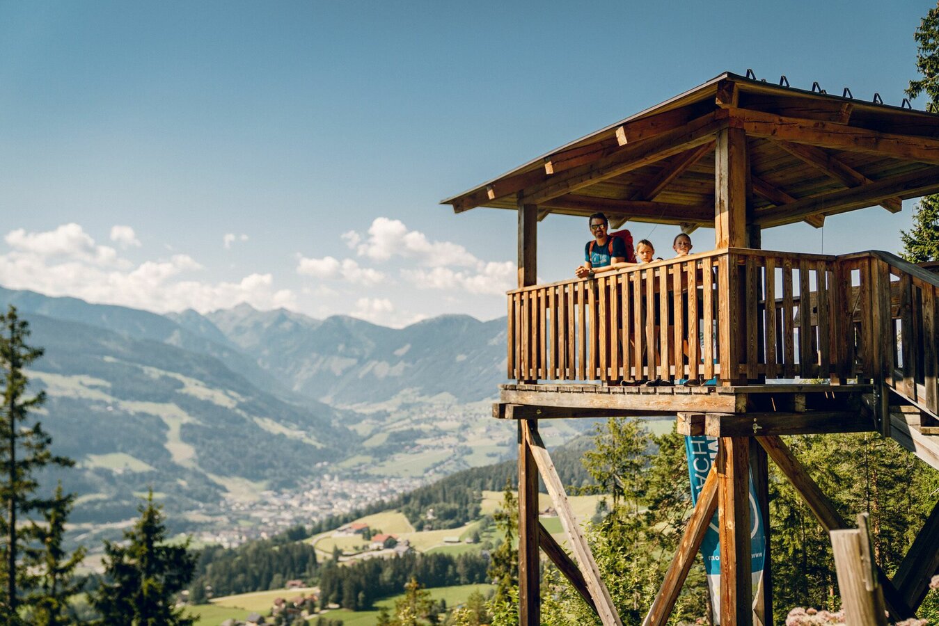


Los geht´s am Ausgangspunkt des Umwelt- und Erlebnispfades. Der liegt am Fuße des Sattelberges, ca. 150 m östlich von der Pension Concordia und ist von Ramsau Kulm in etwa 20 Gehminuten erreichbar. Der Rundweg führt dich in ca. 3 Stunden über den Sattelberggipfel. Von Station 1 bis 3 kommst du abwechselnd über hügeliges und flaches Waldgelände mit mehreren Lichtungen. Ab Station 3 wanderst du bergauf, am oberen Teil der Nordflanke des Sattelberges entlang. Aber keine Sorge, über die Station 5 bis 6 kannst du im flachen Gelände wieder deine Kräfte sammeln, um für den Aufstieg zur Nummer 7, dem Sattelberggipfel, fit zu sein. In nicht mehr als 70 Minuten Gehzeit maschierst du bis hierhin über einen aussichts- und erlebnisreichen Weg, vorbei an Beeren, Blumen, Felstürmen, bizzaren Gesteinstürmen und vielem mehr.
Oben angekommen siehst du schon den Serpentinenweg der sich durch den Wald bis zur Station 11 schlängelt. Von dort an geht es weiter am Waldrand entlang über Baumwurzeln, Lichtungen und hohes Gras bis zur Station 14. Leicht ansteigendes Waldgelände und ein ebener Auslauf beenden schließlich KALIS spannenden Rundweg.
Arriving from the west:
From the west you can take the Munich-Salzburg motorway, continuing on the Tauern motorway (A 10) until the Ennstal junction. From here take the Ennstal A-road (the B 320) for around 30 km into the Schladming-Dachstein region, then take the Ramsau am Dachstein turn-off.
Arriving from the north:
From the south-east take the Pyhrnautobahn motorway (A 9) to the Liezen junction and then the Ennstal A-road (B 320) into the Schladming-Dachstein region. Then take the Ramsau am Dachstein turn-off.
Bus stop Ramsau Leiten Almfrieden
See the timetables HERE
Info office Ramsau am Dachstein or parking lot at the nature and adventure trail (Obere Leiten)
Infos zur Ramsau und der Region Schladming-Dachstein
Infos zur Sattelberghütte
Sommerfreizeitkarte Schladming & Ramsau am Dachstein, erhältlich in den Infobüros des TVB Schladming-Dachstein
Wanderführer Ramsau am Dachstein Reinhard Lamm


